


HIKING AND MTB TRAILS – CLARENS AND SURROUNDS
There are a multitude of excellent hikes in Clarens, Golden Gate Highlands Reserve and on Guest Farms in the area.
The areas and various hikes and details are outlined below.
IN CLARENS
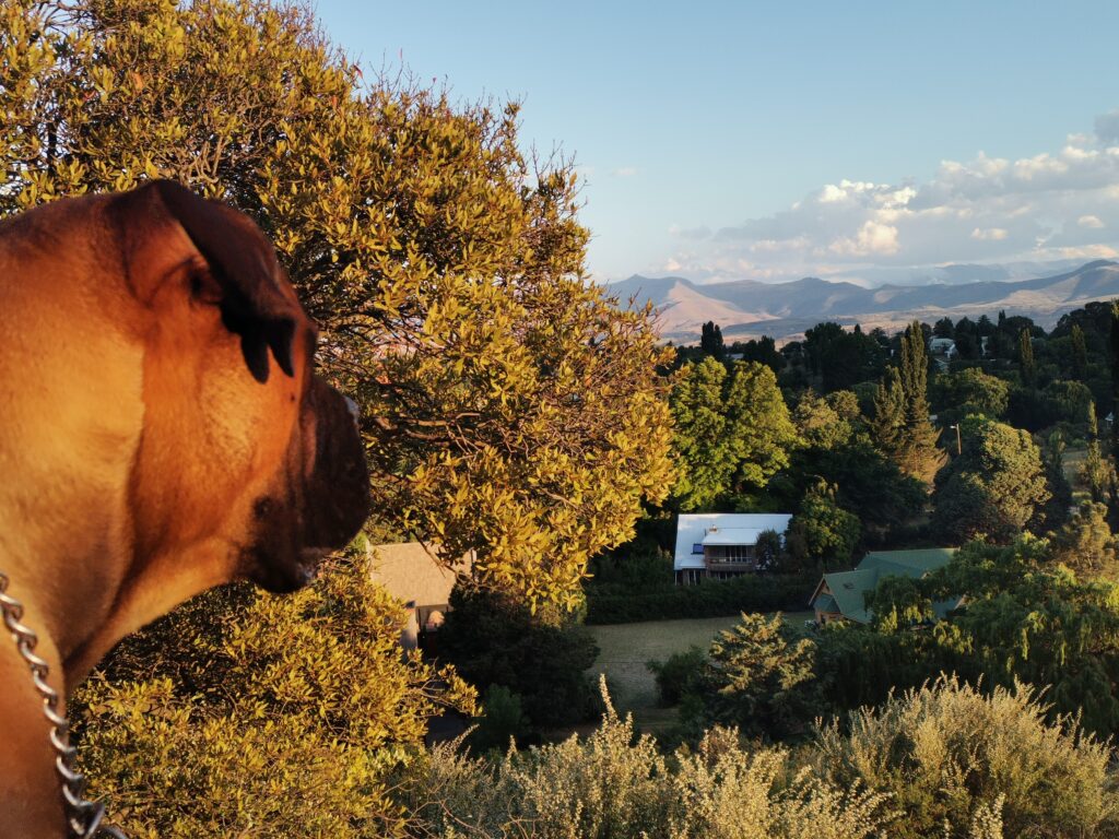
Following a trail directly from our Gypsy Haven, you will have access to a number of hiking and MTB trails of various distances and difficulty, ranging from a 10 min stroll to a couple of hours or more.
The Clarens Village Conservancy heads up the amazing team that maintains the large number of trails in our surrounding mountains. They are constantly working on the routes, creating new trails and making the current ones, even more accessible.
The conservancy is run by a committee and its field rangers. Our conservancy is a non profit supported by residents of Clarens. We all care about our environment and sustainable development. A permit is required for all activities in the Clarens nature reserve, which includes hiking, MTB and fishing for non-members.
Please do the right thing and purchase your permit. R30 per adult. R15 per child – valid for a week. Or you can become a member for R385 per annum. Donations are welcome.
See their website for payment options. https://clarensvillageconservancy.com/, or purchase from one of the participating retailers in town.
Income from permits is used for conservation and to maintain the large number of trails in the Clarens nature Reserve
Some of the information on this page, is courtesy of their website.
If you want to experience the real peace and tranquillity pack a picnic and take a gentle stroll into the mountains.
Breathe…. Calm…. Silence…. Time to listen to your heart…. Time to rejuvenate the senses!
Carry water and leave your troubles on the side of the trail. Take your phone, in the event of emergencies, but more importantly to capture some amazing photos of the views.
Picnic spots are marked with a heart on our map. There are a number of benches located all around the trails.
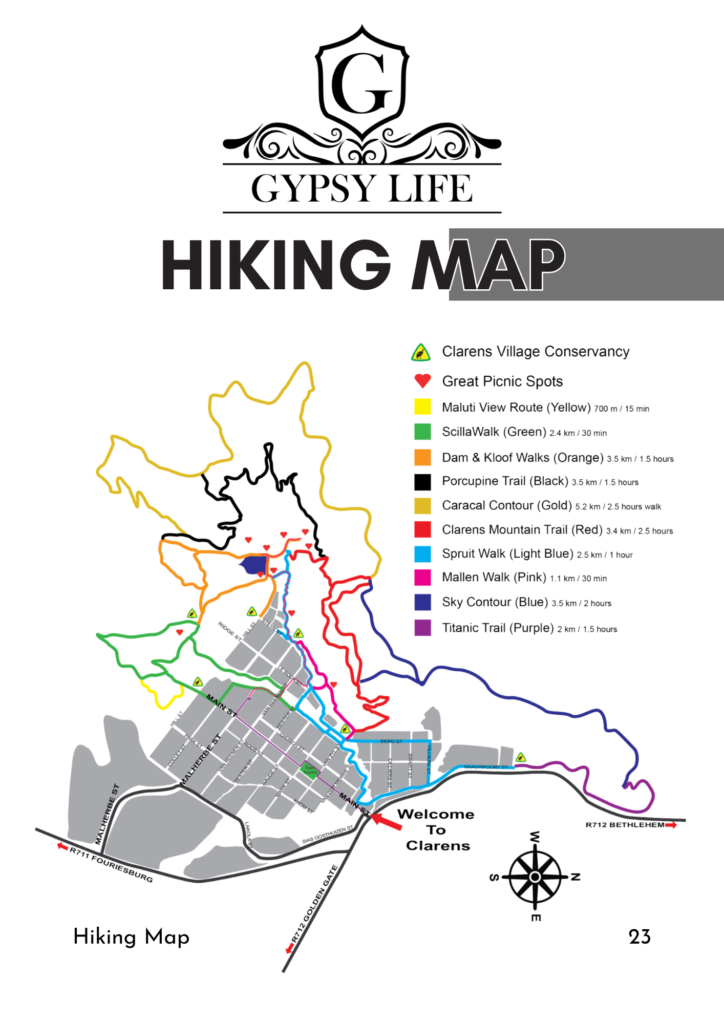
TRAILS IN CLARENS
Dam and Kloof Walks
ADDED DETOUR BY POPULAR DEMAND
(orange) 3.5km/1.5 hours
MTB – Grade 1
We have a new short and scenic route to complete the circular route around the Kloof Dam in the Clarens Nature Reserve. It starts on the dam-wall, on the side closest to the village. An uphill zigzag takes you to a bench after 300 meters. From there, the route is fairly level and mostly follows exposed sandstone. Follow the orange arrows. At the T junction, turn right and complete the route in a clockwise direction.
MTB
Grade 1. All ridable
Spruit Walk
(light blue) 2.5km/1 hour
MTB – Grade 1
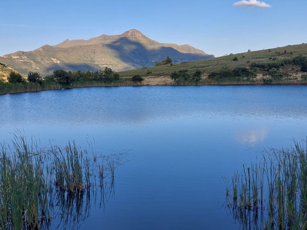
Take the DAM WALK over the dam wall, turn right and turn right again following the blue marker. This is a lovely, mostly shady route along a crystal clear mountain stream (in summer). Cross a few wooden bridges until you reach Le Roux Street. Here the trail splits into two options (left, along the same Kloof Spruit, or right past the log cabin to the Eastern Spruit). Both join up again at the bridge in Van Zyl Street. From here, continue alongside the spruit until you reach Lake Clarens.
MTB
Grade 1:
Mostly ridable except the section between Bester and Malherbe streets. Take a detour via Le Roux and Malherbe Streets.
Clarens Mountain Trail
(light red) 3.4km/2.5 hours
Start with the DAM WALK. After crossing the dam wall, turn right and follow the path with red markers up the mountain side. On the left are sandstone cliffs with a beautiful little waterfall (summers only).
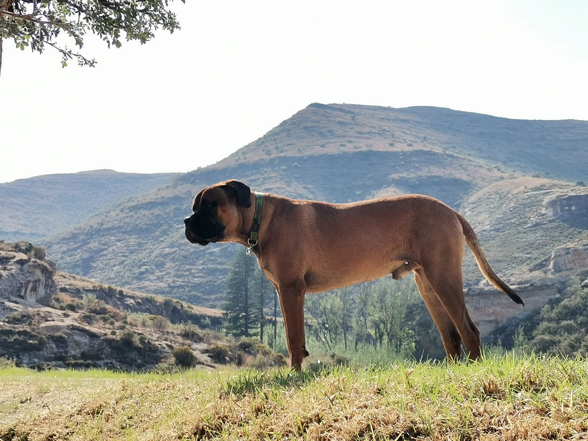
Follow the red markers further and traverse the Clarens Mountain on a contour path. You can choose the higher or lower route. This trail offers beautiful views over the Clarens Village, the Little Caledon River Valley, and the Red Mountains up to Golden Gate National Park. Descend the mountain above Berg Street, or continue on the Sky Contour Trail.
Scilla Walk
(light green) 2.4km/30 min
MTB – Grade 1
This trail is named after the BLUE SCILLA (Merwilla plumbea, Afr: Blouberg-lelie), a protected plant species with a beautiful blue flower which flowers during October. Start at the CVC gate at the top of Main Street, and follow the green markers straight ahead. You will find a bench on the left. From there you have a lovely view of the village and Mount Horeb. This route can be walked as a circular route in either direction or you can continue on the DAM & KLOOF walks. The previously named Maluti View Route (700m/15 min) now forms part of the Scilla Route. This route is a short deviation on the SCILLA TRAIL, onto a solid sandstone ridge from where you have a perfect view of the Maluti Mountain range in Lesotho, sometimes snow-capped during the winter months. This is an ideal vantage point to watch a golden sunset over the Red Mountains.
MTB
Grade 1: All ridable
Porcupine Trail
(black) 3.5km/1. hour
MTB – Grade 3
This is for the hiker who wants to go a little further and really wants to be in the middle of nature. Bikers can follow this route coming from the SKY CONTOUR and CLARENS MOUNTAIN TRAILS.
Follow the dam trail from the CVC gate in Hill Street, then continue up the mountain with the CLARENS MOUNTAIN TRAIL (Blue Mark-ers). Once higher up, turn left at the black marker.
Follow the contour path until it joins the DAM AND KLOOF WALK above the inflow of the dam. From here, you can choose your return route.
MTB
Grade 3: Mostly ridable. Slightly challenging ride with steep ascents and off camber decents. Where it meets the Clarens Mountain trail, either turn around or return via the Caracal Trail.
Caracal Contour
(yellow with black) 5.2km/2.5 hours walk and 20 min cycling
MTB – Grade 2
The best views of Clarens and surrounding landscape, given its high elevation. The vistas from this trail are stunning. The trail has been carefully designed with conservation in mind, and is suitable for mountain bikers and hikers.
Use the DAM AND KLOOF walks to get onto the PORCUPINE trail above the dam inflow. Follow the PORCUPINE TRAIL for a short distance, then turn towards the bench on the sandstone outcrop.
Pass the bench up the mountain via a few switchbacks, then follow the contour path. Walk until the trail joins the CLARENS MOUNTAIN TRAIL.
MTB
Grade 2. All ridable. Flowing single track with some off camber sections and tight downhill switch backs.
Mallen Walk
(pink) 1.1km/30 min
A lovely and easy walk on the Clarens Mountain slope above the SPRUIT WALK. Start in Berg Street close to the junction with Van Zyl Street and follow the path towards the mountain side. Turn left on MALLEN WALK (the right-hand path is the CLARENS MOUNTAIN TRAIL). The path eventually joins the SPRUIT WALK close to Steyn Street. You can also walk any half of the trail by crossing the wooden bridge at the lower end of Le Roux Street, and turn left or right at the T-junction.
Route 2030
(bright green) 1.2km/20 minute
MTB – Grade 2
This route connects the Sky Contour and the Caracal Contour trail, and also passes the highest point on all the Clarens Nature Reserve trails. It crosses a point on the ridge at a height of 2030m above sea level. This route offers the best view of the Clarens Village and surrounding mountains.
MTB
Grade 2: All ridable. Flowing single track that joins up to the Sky Contour and the Caracal Contour.
Titanic Trail
(Magenta) 2km/1.5 hours
MTB Grade 3
The Titanic rock is a large sandstone cliff which has the shape of a ship’s bow. It is named after the well-known passenger steamer that sank in the Atlantic in 1912. This trail takes you past Titanic and then up on the northern slope where it ends above this beautiful rock formation. From here, you can also enjoy a lovely view of the village. Start in Naauwpoort Street just north from the Maluti Lodge Hotel and follow the trail markers. A few switch-backs on the North slope of the mountain will take you to the top. Return on the same Trail, or continue on the SKY CONTOUR.
MTB
Grade 3: Mostly ridable. A good level of fitness and MTB ability is needed. The trail leading up to the Sky Contour trail is steep and some ‘hike your bike’ will be required to get up. The single track is narrow in sections so take caution. But it is worth the effort as the views are breath taking!
Sky Contour
(blue) 3.5 km/2 hours
MTB Grade 2
The SKY CONTOUR is a 3,5km trail, joining the TITANIC TRAIL and the CLARENS MOUNTAIN TRAIL. Start with the TITANIC TRAIL and walk North to South following the blue route markers, or the other way starting with the CLARENS MOUNTAIN TRAIL.
MTB
Grade 2: All ridable. Flowing single track linking the Titanic Trail and Route 2030.
Mount Horeb Climb
The Mount Horeb Climb is not a CVC trail, but is listed here for those interested in a more challenging hike, and a better view.
Book your hike up Mount Horeb with Clarens Xtreme .
Elevation at start point is approximately 1850m. Mount Horeb elevation is 2449m.
Guest farms
St Fort Farm
4 km on the Fouriesburg road.
St Fort Farm, the home of the Mushroom Rock, is situated in the foothills of the Maluti Mountains that hug the Lesotho border.
St Fort Farm offers 4 expertly laid out hiking trails that can be enjoyed by young and old, experienced and adventurous hikers, and by those who are just learning to discover the joys of hiking.
All these trails take you through differing landscapes, from breathtaking mountain views and overhang caves, to river walks with numerous picnic spots, forest ambles, and boulder hopping in and along gorges.
Call before had to gain permission and access. +27 78 457 2504
Meiringskloof Nature Reserve
In Fouriesburg is well known for its sandstone caves and water tunnels. There is also a short chain ladder to access the summit.
Adults R25 Childern R20
Contact 058 223 0067
There are a number of Cycling and running events, where participants can access trails on private farms. See EVENTS for more info.
Golden Gate Highlands National Park
Managed by San Parks, is a 20 minute drive from Clarens.
There are drives and various hikes in the park.
Daily Conservation Fees
South African Citizens and Residents (with ID) R63 per adult, per day
R31 per child, per day
Standard Conservation Fee (International Visitors) R252 per adult, per day
R126 per child, per day
Camp site R 300 – R 350 per night.
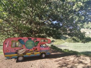
Enquire about hiring one of our Gypsy Vans to camp at the Glen Reenen Camp.
Self Drive, or we can set it all up for you. Enjoy a few nights in the heart of Golden Gate. (Camping is not recommended in Winter – temperatures often plummet well below – 5’C)
Ribbok Hiking Trail
The more adventurous should follow the 28km Ribbok Hiking Trail where black wildebeest, blesbok, burchell’s zebra, eland, red hartebeest and springbok are often seen, as well as the rare bearded vulture, bald ibis and black eagle. Some 200 bird species have been identified in the Park.
Cathedral Cave Hike
Duration: Four hours.
Guided Hike with a low difficulty grading.
Minimum Group Number: Five.
Advance booking essential.
Route available from December to October.
Wodehouse Hike
Duration; Approximately four hours.
Unguided hike with a low level of difficulty.
Suitable for young children.
Start and End: Glen Reenen camping site.
Mushroom Rock Hike
Duration: Approximately one hour.
Unguided with a low level of difficulty.
Suitable for young children.
Start and End: Glen Reenen Rest Camp
Eco-Ravine Hike
Duration: Approximately one hour.
Unguided with a medium level of difficulty.
Suitable for young children.
Start and End: Glen Reenen Rest Camp.
Boskloof Hike
Duration: Approximately one hour.
Unguided with a medium level of difficulty.
Start and End: Glen Reenen Rest Camp.
Holkrans Hike
Duration: Approximately one hour.
Unguided hike with an easy to medium level of difficulty.
Start: Hotel Chalets Area.
Brandwag Rock Hike
Duration: Approximately one hour.
Unguided loop hike, suitable for accompanied children with medium degree of difficulty. This hike has a chain to help with a steep accent.
Start and End: Either from the Hotel or Glen Reenen End.